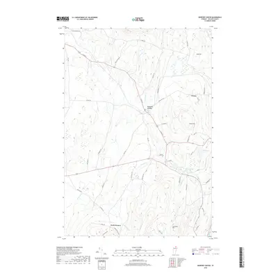
2018 Map of Newport Center
USGS Topo · Published 2018About this map
Newport Center and South Newport anchor this section of Orleans County, where the landscape is defined by the winding course of Dunn Brook and the high points of the northern Vermont terrain. The area's rural character is evident in the network of family-named roads like Buzzell Rd, Niles Rd, and Kittredge Rd that connect isolated farms and woodlots. Significant local landmarks include Newport Center Cem and a cluster of water bodies such as Sargent Pond and Smith Pond. To the east, the terrain rises toward Coburn Hill and Allen Hill, while the Black River skirts the eastern boundary. This layout reflects the persistent agricultural and forestry roots of the region, where settlement patterns follow the natural contours of the hills and the drainage of the brooks.
Find a feature on this map
47 named features on this map. Tap any name to fly to it.
Don’t see what you’re looking for? This feature index may not catch every label — zoom into the map to look around manually.
Map Details
Editions of this 2018 Newport Center Map
This is the sole edition of this map. No revisions or reprints were ever made.
Other maps of this area

1919 · Lake Memphremagog
USGS Topo · 1:62,500

1920 · Derby
USGS Topo · 1:62,500

1920 · Irasburg
USGS Topo · 1:62,500

1923 · Irasburg
USGS Topo · 1:48,000

1923 · Lake Memphremagog
USGS Topo · 1:48,000

1925 · Irasburg
USGS Topo · 1:62,500

1925 · Memphremagog
USGS Topo · 1:62,500

1950 · Lake Champlain
USGS Topo · 1:250,000

1953 · Irasburg
USGS Topo · 1:62,500
1953 · Memphremagog
USGS Topo · 1:62,500