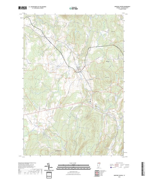
2024 Map of Newport Center
USGS Topo · Published 2024About this map
Newport Center and the village of Orleans anchor this northern Vermont landscape, where the terrain transitions from the elevations of Coburn Hill and Cleveland Hill into the drainage basins of Mud Creek and Stony Brook. The settlement pattern is defined by a dense network of local routes like W Main St and Bear Mountain Rd, alongside numerous recreation and utility paths such as the 105 Trl. This modern survey reveals how the historical rural footprint persists through names like South Newport and the Newport Center Cem, while highlighting the hydrography of the region's scattered upland waters, including Smith Pond and Walker Pond. The prominence of local family-named roads like Drouin Mill Rd and Routhier Rd provides a clear link to the area's genealogical history and land-use development.
Find a feature on this map
56 named features on this map. Tap any name to fly to it.
Don’t see what you’re looking for? This feature index may not catch every label — zoom into the map to look around manually.
Map Details
Editions of this 2024 Newport Center Map
This is the sole edition of this map. No revisions or reprints were ever made.
Other maps of this area

1919 · Lake Memphremagog
USGS Topo · 1:62,500

1920 · Derby
USGS Topo · 1:62,500

1920 · Irasburg
USGS Topo · 1:62,500

1923 · Irasburg
USGS Topo · 1:48,000

1923 · Lake Memphremagog
USGS Topo · 1:48,000

1925 · Irasburg
USGS Topo · 1:62,500

1925 · Memphremagog
USGS Topo · 1:62,500

1950 · Lake Champlain
USGS Topo · 1:250,000

1953 · Irasburg
USGS Topo · 1:62,500
1953 · Memphremagog
USGS Topo · 1:62,500