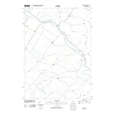
2010 Map of Newport
USGS Topo · Published 2010About this map
West Canada Creek anchors this section of Herkimer County, winding past the village of Poland and through the center of Newport. The landscape is defined by its numerous small hamlets and namesake crossroads, such as Brayton Corners, Farrel Corner, and Walker Corners, which reflect a historical pattern of rural settlement. In the southern portion of the map, Irish Settlement and Smoky Hollow speak to the specific cultural and geographical pockets that developed around the ridges of Tanner Hill and the deep cut of Hawthorne Gulf. Local history and genealogy are well-represented by several burial grounds, including Saint Johns Cemetery and Pine Grove Cemetery. The terrain is marked by distinct geological features like Oklahoma Gulf and Brown Island, while a dense network of roads like Military Rd and Old State Rd suggests the long-established transit corridors of the region.
Find a feature on this map
66 named features on this map. Tap any name to fly to it.
Don’t see what you’re looking for? This feature index may not catch every label — zoom into the map to look around manually.
Map Details
Editions of this 2010 Newport Map
This is the sole edition of this map. No revisions or reprints were ever made.
Other maps of this area

1897 · Remsen
USGS Topo · 1:62,500

1898 · Utica
USGS Topo · 1:62,500

1900 · Little Falls
USGS Topo · 1:62,500

1900 · Utica
USGS Topo · 1:62,500

1900 · Remsen
USGS Topo · 1:62,500

1900 · Wilmurt
USGS Topo · 1:62,500

1902 · Wilmurt
USGS Topo · 1:62,500

1903 · Little Falls
USGS Topo · 1:62,500

1939 · Little Falls
USGS Topo · 1:62,500

1943 · Newport
USGS Topo · 1:24,000