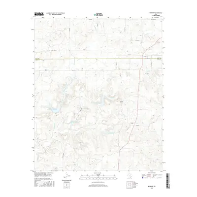
2016 Map of Newport
USGS Topo · Published 2016About this map
The border of Clay Co and Jack Co divides this North Texas landscape, where the small community of Newport sits at the intersection of FM 1288 and Deweber Rd. To the south, the settlement of Truce anchors a region characterized by the branching drainages of the Crooked Creek system. The map reveals an extensive water management network, featuring several large catchments such as the Soil Conservation Service Site 1 Reservoir and its counterparts, sites 2, 3, and 3b. These reservoirs are integrated into a terrain of low ridges, including the prominent Galliher Mtn. Genealogists will find the Newport Cem located near Gray Lake east of the main townsite. The rural road network, including family-named routes like Lowell Scott Rd and McAlister Ln, provides a clear view of the area's agricultural and ranching layout.
Find a feature on this map
35 named features on this map. Tap any name to fly to it.
Don’t see what you’re looking for? This feature index may not catch every label — zoom into the map to look around manually.
Map Details
Editions of this 2016 Newport Map
This is the sole edition of this map. No revisions or reprints were ever made.
Other maps of this area

1905 · Montague
USGS Topo · 1:125,000

1954 · Sherman
USGS Topo · 1:250,000

1954 · Wichita Falls
USGS Topo · 1:250,000

1958 · Wichita Falls
USGS Topo · 1:250,000

1958 · Sherman
USGS Topo · 1:250,000

1961 · Brushy Mound
USGS Topo · 1:24,000

1961 · Selma
USGS Topo · 1:24,000

1961 · Crafton
USGS Topo · 1:24,000
1963 · Vashti
USGS Topo · 1:24,000

1964 · Cundiff
USGS Topo · 1:24,000