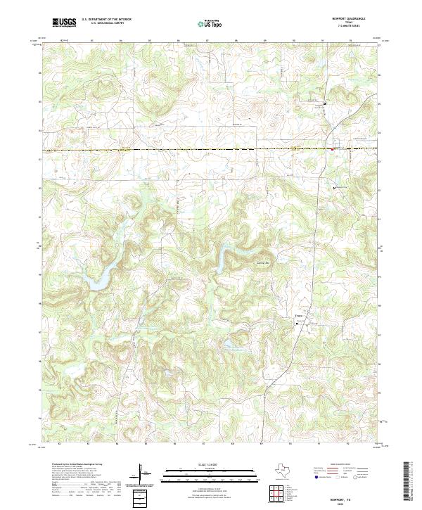
2022 Map of Newport
USGS Topo · Published 2022About this map
The small community of Truce serves as a central point in this rural Jack County landscape, where the boundary with Clay County runs across the northern reaches. The area is defined by the complex drainage of North Fork Crooked Creek and the East Fork Crooked Creek, which carve through the terrain near the prominent Galliher Mtn. This 2022 survey documents a countryside maintained by soil conservation efforts, evident in features like the Soil Conservation Service Site 2 Reservoir and Soil Conservation Service Site 3 Reservoir. Local genealogy and history are preserved through several documented burial sites, including the Newport Cem near Gray Lake, the Truce Cem, and the family-named Swaggerty-Garrett Cem. The map illustrates a network of rural roads such as W Bugscuffle Rd and Frog Hollar Rd that connect isolated homesteads and pastures.
Find a feature on this map
34 named features on this map. Tap any name to fly to it.
Don’t see what you’re looking for? This feature index may not catch every label — zoom into the map to look around manually.
Map Details
Editions of this 2022 Newport Map
This is the sole edition of this map. No revisions or reprints were ever made.
Other maps of this area

1905 · Montague
USGS Topo · 1:125,000

1954 · Sherman
USGS Topo · 1:250,000

1954 · Wichita Falls
USGS Topo · 1:250,000

1958 · Wichita Falls
USGS Topo · 1:250,000

1958 · Sherman
USGS Topo · 1:250,000

1961 · Brushy Mound
USGS Topo · 1:24,000

1961 · Selma
USGS Topo · 1:24,000

1961 · Crafton
USGS Topo · 1:24,000
1963 · Vashti
USGS Topo · 1:24,000

1964 · Cundiff
USGS Topo · 1:24,000