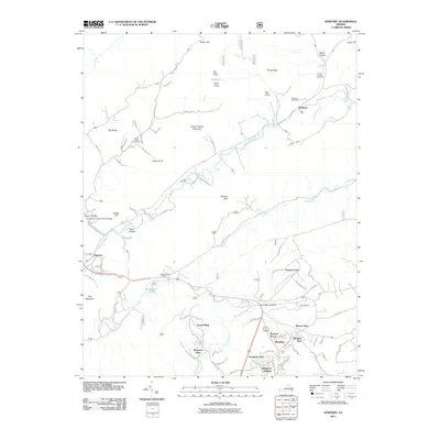
2011 Map of Newport
USGS Topo · Published 2011About this map
Clover Hollow Sinking Creek Covered Bridge stands as a landmark in the western portion of this landscape, where Sinking Creek cuts through the valley floor. The settlement of Newport serves as a local hub near the base of Gap Mountain, while residential pockets such as Meadow Brook, Preston Forest, and Woodbine cluster near the southern reaches toward the college town of Blacksburg. The area is defined by a series of prominent ridges, including Clover Hollow Mountain and Laurel Ridge, which create a complex drainage system feeding into Craig Creek and Toms Creek.
Find a feature on this map
93 named features on this map. Tap any name to fly to it.
Don’t see what you’re looking for? This feature index may not catch every label — zoom into the map to look around manually.
Map Details
Editions of this 2011 Newport Map
This is the sole edition of this map. No revisions or reprints were ever made.
Other maps of this area

1890 · Dublin
USGS Topo · 1:125,000

1890 · Christiansburg
USGS Topo · 1:125,000

1891 · Dublin
USGS Topo · 1:125,000

1923 · Pearisburg
USGS Topo · 1:62,500

1923 · Waiteville
USGS Topo · 1:62,500

1931 · Waiteville
USGS Topo · 1:48,000

1932 · Pearisburg
USGS Topo · 1:48,000

1932 · Blacksburg
USGS Topo · 1:48,000

1937 · Pearisburg
USGS Topo · 1:62,500

1937 · Blacksburg
USGS Topo · 1:62,500