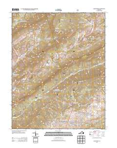
2013 Map of Newport
USGS Topo · Published 2013About this map
Clover Hollow Mountain and Gap Mountain define the topography of this corner of the Appalachian highlands, where long ridgelines dictate the flow of both water and local commerce. The historic Newport settlement sits at a crossroads near the western edge of the map, situated where Sinking Cr winds through the valley. A notable preservation landmark, the Sinking Creek Covered Bridge, stands near Clover Hollow, reflecting the rural infrastructure that once dominated this region. To the southeast, modern residential growth is evident in developments like Preston Forest and Meadow Brook, which cluster near the larger community of Mount Tabor Village. This transition from the remote northern peaks like Wolf Knob to the more densely settled neighborhoods near Northside Park illustrates the ongoing evolution of the land use patterns outside of Blacksburg.
Find a feature on this map
118 named features on this map. Tap any name to fly to it.
Don’t see what you’re looking for? This feature index may not catch every label — zoom into the map to look around manually.
Map Details
Editions of this 2013 Newport Map
This is the sole edition of this map. No revisions or reprints were ever made.
Other maps of this area

1890 · Dublin
USGS Topo · 1:125,000

1890 · Christiansburg
USGS Topo · 1:125,000

1891 · Dublin
USGS Topo · 1:125,000

1923 · Pearisburg
USGS Topo · 1:62,500

1923 · Waiteville
USGS Topo · 1:62,500

1931 · Waiteville
USGS Topo · 1:48,000

1932 · Pearisburg
USGS Topo · 1:48,000

1932 · Blacksburg
USGS Topo · 1:48,000

1937 · Pearisburg
USGS Topo · 1:62,500

1937 · Blacksburg
USGS Topo · 1:62,500