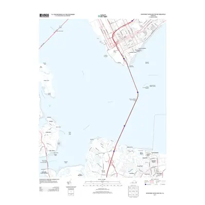
2013 Map of Newport News South
USGS Topo · Published 2013About this map
Newport News Middle Ground Lighthouse stands as a sentinel in the James River, marking the point where the channel meets the Nansemond River. This maritime landscape is defined by its deep-water terminals and complex shoreline, where the massive infrastructure of the Newport News Marine Terminal and Newport News Cruise Terminal contrasts with the residential clusters along the southern banks. The map documents a modern Hampton Roads, showing how transportation arteries like the James River Bridge and the Monitor - Merrimac Memorial Bridge Tunnel link the industrial hub of Newport News to the growing communities of Southampton, Holly Acres, and Eclipse. Inland, the terrain is shaped by a network of tidal creeks including Hoffler Creek, Streeter Cr, and Bennett Creek, which weave through suburban developments like Brandon Square and Arbor Meadows.
Find a feature on this map
156 named features on this map. Tap any name to fly to it.
Don’t see what you’re looking for? This feature index may not catch every label — zoom into the map to look around manually.
Map Details
Editions of this 2013 Newport News South Map
This is the sole edition of this map. No revisions or reprints were ever made.
Other maps of this area

1907 · Norfolk
USGS Topo · 1:125,000

1907 · Yorktown
USGS Topo · 1:62,500

1907 · Hampton
USGS Topo · 1:62,500

1919 · Smithfield
USGS Topo · 1:62,500

1921 · Newport News
USGS Topo · 1:62,500

1943 · Yorktown
USGS Topo · 1:62,500

1943 · Richmond
USGS Topo · 1:250,000

1944 · Hampton
USGS Topo · 1:24,000

1944 · Morrison
USGS Topo · 1:24,000

1944 · Norfolk South
USGS Topo · 1:25,000