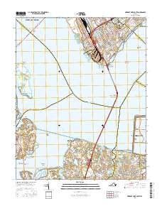
2016 Map of Newport News South
USGS Topo · Published 2016About this map
The James River and Nansemond River converge in this coastal area, dominated by the massive infrastructure of the Monitor - Merrimac Memorial Bridge - Tunnel. On the northern shore, the urban industrial waterfront of Newport News and Hampton features a dense grid of streets such as Warwick Blvd and Jefferson Ave. Across the water, the landscape shifts toward the marshy reaches of Isle of Wight County and the northern edge of Suffolk. This geography is defined by a complex network of shoals, including Willis John Shoal and Noggins Shoal, which historically dictated the maritime approach to these Hampton Roads ports. Smaller communities like Eclipse and Crittenden provide a glimpse into the tidal-influenced settlements that line the western banks, where land is deeply articulated by inlets like Chuckatuck Creek and Bleakhorn Creek.
Find a feature on this map
163 named features on this map. Tap any name to fly to it.
Don’t see what you’re looking for? This feature index may not catch every label — zoom into the map to look around manually.
Map Details
Editions of this 2016 Newport News South Map
This is the sole edition of this map. No revisions or reprints were ever made.
Other maps of this area

1907 · Norfolk
USGS Topo · 1:125,000

1907 · Yorktown
USGS Topo · 1:62,500

1907 · Hampton
USGS Topo · 1:62,500

1919 · Smithfield
USGS Topo · 1:62,500

1921 · Newport News
USGS Topo · 1:62,500

1943 · Yorktown
USGS Topo · 1:62,500

1943 · Richmond
USGS Topo · 1:250,000

1944 · Hampton
USGS Topo · 1:24,000

1944 · Morrison
USGS Topo · 1:24,000

1944 · Norfolk South
USGS Topo · 1:25,000