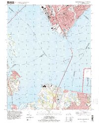
1994 Map of Newport News South
USGS Topo · Published 2000About this map
Newport News and Hampton anchor this maritime-focused survey, showcasing the intense industrial and urban development along the northern bank of Hampton Roads. The map reveals a dense network of civic infrastructure, including the Virginia School for the Deaf and Blind and several parochial landmarks like St Vincent de Paul Ch. This built environment contrasts sharply with the tidal marshes of Ragged Island and the rural reaches of Eclipse and Crittenden across the James River.
Find a feature on this map
62 named features on this map. Tap any name to fly to it.
Don’t see what you’re looking for? This feature index may not catch every label — zoom into the map to look around manually.
Map Details
Editions of this 1994 Newport News South Map
This is the sole edition of this map. No revisions or reprints were ever made.
Other maps of this area

1907 · Norfolk
USGS Topo · 1:125,000

1907 · Yorktown
USGS Topo · 1:62,500

1907 · Hampton
USGS Topo · 1:62,500

1919 · Smithfield
USGS Topo · 1:62,500

1921 · Newport News
USGS Topo · 1:62,500

1943 · Yorktown
USGS Topo · 1:62,500

1943 · Richmond
USGS Topo · 1:250,000

1944 · Hampton
USGS Topo · 1:24,000

1944 · Morrison
USGS Topo · 1:24,000

1944 · Norfolk South
USGS Topo · 1:25,000