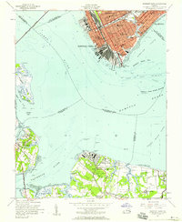
1955 Map of Newport News
USGS Topo · Published 1958About this map
Newport News and the surrounding Tidewater landscape appear in mid-century detail, centered on the strategic confluence of the James River and Hampton Roads. The urban grid of the port city is densely packed with educational and civic institutions, including the Virginia School For Deaf and Blind, Mary Immaculate Hospital, and several segregated-era schools such as Huntington High Sch and the 16th Dunbar Sch. The waterfront is dominated by the massive rail terminals of the Chesapeake & Ohio Ry at Newport News Point, highlighting the city's role as a primary shipping hub.
Find a feature on this map
61 named features on this map. Tap any name to fly to it.
Don’t see what you’re looking for? This feature index may not catch every label — zoom into the map to look around manually.
Map Details
Editions of this 1955 Newport News Map
This is the sole edition of this map. No revisions or reprints were ever made.
Other maps of this area

1907 · Norfolk
USGS Topo · 1:125,000

1907 · Yorktown
USGS Topo · 1:62,500

1907 · Hampton
USGS Topo · 1:62,500

1919 · Smithfield
USGS Topo · 1:62,500

1921 · Newport News
USGS Topo · 1:62,500

1943 · Yorktown
USGS Topo · 1:62,500

1943 · Richmond
USGS Topo · 1:250,000

1944 · Hampton
USGS Topo · 1:24,000

1944 · Morrison
USGS Topo · 1:24,000

1944 · Norfolk South
USGS Topo · 1:25,000