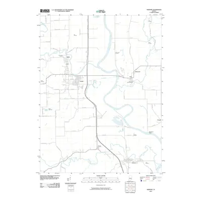
2010 Map of Newport
USGS Topo · Published 2010About this map
The Wabash River and its meandering tributaries define the landscape of Vermillion County in this 21st-century record. The confluence of the Vermilion River and the main river channel anchors the settlements of Eugene and Cayuga, where the riparian environment is shaped by both natural flow and human engineering at the Chew Lake Dam. A notable architectural landmark, the Coal Creek Covered Bridge, stands near Lodi, preserving a link to traditional river crossings in an area otherwise dominated by a grid of county roads.
Find a feature on this map
58 named features on this map. Tap any name to fly to it.
Don’t see what you’re looking for? This feature index may not catch every label — zoom into the map to look around manually.
Map Details
Editions of this 2010 Newport Map
This is the sole edition of this map. No revisions or reprints were ever made.
Other maps of this area

1899 · Danville
USGS Topo · 1:62,500

1900 · Danville
USGS Topo · 1:62,500

1947 · Ridge Farm
USGS Topo · 1:62,500

1950 · Danville SE
USGS Topo · 1:24,000

1951 · Danville SE
USGS Topo · 1:24,000

1953 · Danville
USGS Topo · 1:250,000

1953 · Indianapolis
USGS Topo · 1:250,000

1955 · Danville
USGS Topo · 1:250,000

1955 · Kingman
USGS Topo · 1:24,000

1955 · Humrick
USGS Topo · 1:24,000