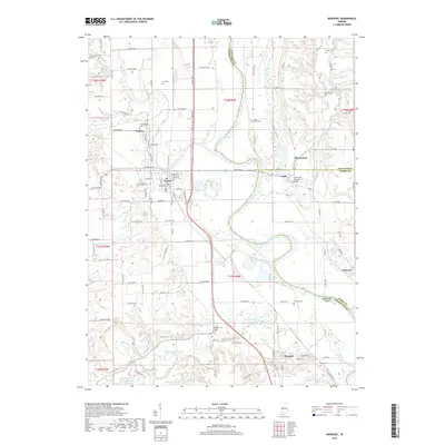
2019 Map of Newport
USGS Topo · Published 2019About this map
The Wabash River and its major tributaries, the Vermillion River and Little Vermillion River, define the landscape of this western Indiana borderland. Settlement patterns center on the historic hubs of Cayuga and Eugene, where a grid of streets like Walnut St and N Main St meet the surrounding agricultural reaches. Genealogists will find a high density of family and community burial grounds, including the Groendyke Cem and Isle Cem, alongside rural landmarks like the Coal Creek Covered Bridge near Lodi. The topography reveals the complex hydrology of the region, featuring Manhattan Island and the winding course of Jonathan Cr. Modern developments such as the Cayuga Park Pathway are documented alongside established small communities like Silverwood, Howard, and Newport, reflecting the long-term continuity of these river-valley townships.
Find a feature on this map
80 named features on this map. Tap any name to fly to it.
Don’t see what you’re looking for? This feature index may not catch every label — zoom into the map to look around manually.
Map Details
Editions of this 2019 Newport Map
This is the sole edition of this map. No revisions or reprints were ever made.
Other maps of this area

1899 · Danville
USGS Topo · 1:62,500

1900 · Danville
USGS Topo · 1:62,500

1947 · Ridge Farm
USGS Topo · 1:62,500

1950 · Danville SE
USGS Topo · 1:24,000

1951 · Danville SE
USGS Topo · 1:24,000

1953 · Danville
USGS Topo · 1:250,000

1953 · Indianapolis
USGS Topo · 1:250,000

1955 · Danville
USGS Topo · 1:250,000

1955 · Kingman
USGS Topo · 1:24,000

1955 · Humrick
USGS Topo · 1:24,000