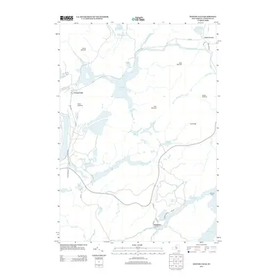
2013 Map of Newton Falls
USGS Topo · Published 2013About this map
The Oswegatchie River and its complex network of tributaries define the landscape surrounding the settlements of Newton Falls and Wanakena. This 2013 survey illustrates a region where water and high ground dictate the layout of community and transport, notably seen in the winding course of Benson Mines Rd and Co Rte 60. To the east, the map captures the western reaches of Cranberry Lake and the prominent Flatiron Point.
Find a feature on this map
43 named features on this map. Tap any name to fly to it.
Don’t see what you’re looking for? This feature index may not catch every label — zoom into the map to look around manually.
Map Details
Editions of this 2013 Newton Falls Map
This is the sole edition of this map. No revisions or reprints were ever made.
Other maps of this area

1915 · Russell
USGS Topo · 1:62,500

1916 · Oswegatchie
USGS Topo · 1:62,500

1918 · Russell
USGS Topo · 1:62,500

1918 · Oswegatchie
USGS Topo · 1:62,500

1919 · Cranberry Lake
USGS Topo · 1:62,500

1921 · Cranberry Lake
USGS Topo · 1:62,500

1921 · Stark
USGS Topo · 1:62,500

1923 · Stark
USGS Topo · 1:62,500

1931 · Cranberry Lake
USGS Topo · 1:62,500

1940 · Stark
USGS Topo · 1:62,500