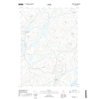
2019 Map of Newton Falls
USGS Topo · Published 2019About this map
Newton Falls and Wanakena serve as the primary human outposts in this 2019 survey of the Saint Lawrence County wilderness. The area is defined by the winding course of the Oswegatchie River and the expansive Adirondack Park Preserve, where water dominates the landscape through features like Chaumont Pond, Dead Creek Flow, and the sprawling Chaumont Swamp. This map captures the region's managed natural character, showing how local infrastructure like River Rd and Co Rd 60 navigates around prominent peaks including Spruce Mtn and Rocky Mtn. For those interested in the hydrology of the North Country, the map traces the intricate connections between Little Moosehead Pond and the various outlets and brooks that feed the river system. The presence of the Ranger School Rd near Wanakena points to the long-standing educational and conservation history inherent to this section of the Adirondacks.
Find a feature on this map
37 named features on this map. Tap any name to fly to it.
Don’t see what you’re looking for? This feature index may not catch every label — zoom into the map to look around manually.
Map Details
Editions of this 2019 Newton Falls Map
This is the sole edition of this map. No revisions or reprints were ever made.
Other maps of this area

1915 · Russell
USGS Topo · 1:62,500

1916 · Oswegatchie
USGS Topo · 1:62,500

1918 · Russell
USGS Topo · 1:62,500

1918 · Oswegatchie
USGS Topo · 1:62,500

1919 · Cranberry Lake
USGS Topo · 1:62,500

1921 · Cranberry Lake
USGS Topo · 1:62,500

1921 · Stark
USGS Topo · 1:62,500

1923 · Stark
USGS Topo · 1:62,500

1931 · Cranberry Lake
USGS Topo · 1:62,500

1940 · Stark
USGS Topo · 1:62,500