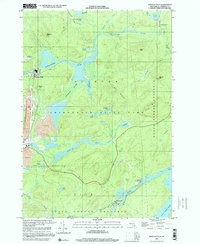
1999 Map of Newton Falls
USGS Topo · Published 2001About this map
Industrial and wilderness landscapes converge along the Oswegatchie River in this survey of the St. Lawrence County highlands. The settlement of Newton Falls is characterized by its heavy resource footprint, including an Industrial Waste Pond, Strip Mine, and several significant Mine Dump sites. These utility-driven features sit in stark contrast to the surrounding Adirondack State Park, where the terrain rises toward Buck Mtn and Twin Mountain.
Find a feature on this map
45 named features on this map. Tap any name to fly to it.
Don’t see what you’re looking for? This feature index may not catch every label — zoom into the map to look around manually.
Map Details
Editions of this 1999 Newton Falls Map
This is the sole edition of this map. No revisions or reprints were ever made.
Other maps of this area

1915 · Russell
USGS Topo · 1:62,500

1916 · Oswegatchie
USGS Topo · 1:62,500

1918 · Russell
USGS Topo · 1:62,500

1918 · Oswegatchie
USGS Topo · 1:62,500

1919 · Cranberry Lake
USGS Topo · 1:62,500

1921 · Cranberry Lake
USGS Topo · 1:62,500

1921 · Stark
USGS Topo · 1:62,500

1923 · Stark
USGS Topo · 1:62,500

1931 · Cranberry Lake
USGS Topo · 1:62,500

1940 · Stark
USGS Topo · 1:62,500