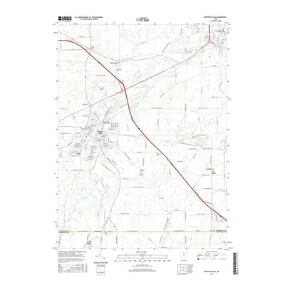
2016 Map of Newton Falls
USGS Topo · Published 2016About this map
The Mahoning River meanders through Trumbull County, defining the industrial and civic heart of Newton Falls. This region is characterized by its convergence of water and transit, where the river meets the West Branch Mahoning River and the Newton Falls Reservoir. A key architectural landmark, the Newton Falls Covered Bridge, stands near the center of town, serving as a rare survivor of earlier transportation infrastructure. The landscape further north transitions toward Braceville and Ridge Hill, while the Ohio Tpke cuts a modern diagonal across the traditional grid of township roads. Genealogists will find a high density of burial sites throughout the quadrangle, including the Braceville Center Cem, Saint Michaels Cem, and German Cem, which speak to the area's diverse early settlement patterns. To the south, the boundary with Mahoning County is marked by Pricetown and the northern reaches of Lake Milton, where the rural character remains evident despite the proximity of larger hubs like Lordstown and Leavittsburg.
Find a feature on this map
130 named features on this map. Tap any name to fly to it.
Don’t see what you’re looking for? This feature index may not catch every label — zoom into the map to look around manually.
Map Details
Editions of this 2016 Newton Falls Map
This is the sole edition of this map. No revisions or reprints were ever made.
Other maps of this area

1905 · Bristolville
USGS Topo · 1:62,500

1905 · Garrettsville
USGS Topo · 1:62,500

1906 · Ravenna
USGS Topo · 1:62,500

1907 · Bristolville
USGS Topo · 1:62,500

1907 · Garrettsville
USGS Topo · 1:62,500

1908 · Warren
USGS Topo · 1:62,500

1908 · Ravenna
USGS Topo · 1:62,500

1950 · Cleveland
USGS Topo · 1:250,000

1952 · Lake Milton
USGS Topo · 1:24,000

1952 · Canfield
USGS Topo · 1:24,000