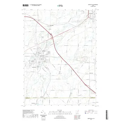
2019 Map of Newton Falls
USGS Topo · Published 2019About this map
Newton Falls sits at the confluence of the Mahoning River and its West Branch, serving as the primary hub for this portion of Trumbull County. The town's historic layout includes the notable Newton Falls Covered Bridge and a cluster of established neighborhoods like South Canal. To the north, Braceville is marked by the Braceville Airport and several rural intersections, while Leavittsburg occupies the northeastern corner where the river continues its eastward course. The landscape is predominantly defined by the winding river valleys and the presence of numerous small cemeteries, such as Price Mill Cem and Wilderson Cem, which suggest a long history of local settlement and family farmsteads. In the south, the terrain transitions toward the northern reaches of Lake Milton near Craig Beach, where the boundary between Trumbull and Mahoning counties is clearly delineated.
Find a feature on this map
147 named features on this map. Tap any name to fly to it.
Don’t see what you’re looking for? This feature index may not catch every label — zoom into the map to look around manually.
Map Details
Editions of this 2019 Newton Falls Map
This is the sole edition of this map. No revisions or reprints were ever made.
Other maps of this area

1905 · Bristolville
USGS Topo · 1:62,500

1905 · Garrettsville
USGS Topo · 1:62,500

1906 · Ravenna
USGS Topo · 1:62,500

1907 · Bristolville
USGS Topo · 1:62,500

1907 · Garrettsville
USGS Topo · 1:62,500

1908 · Warren
USGS Topo · 1:62,500

1908 · Ravenna
USGS Topo · 1:62,500

1950 · Cleveland
USGS Topo · 1:250,000

1952 · Lake Milton
USGS Topo · 1:24,000

1952 · Canfield
USGS Topo · 1:24,000