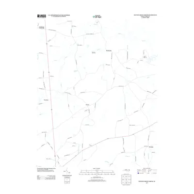
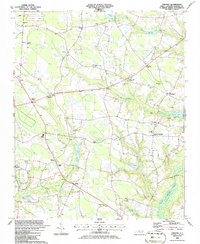
2013 Map of Newton Grove North
USGS Topo · Published 2013About this map
Bentonville Battlefield serves as a major focal point of this rural landscape, reflecting the preservation of American Civil War history within modern North Carolina. The surrounding terrain is characterized by a dense network of watercourses and swamps, including the notable Beaverdam Swamp and Kill Swamp, which dictate the local drainage patterns into Falling Cr. Small, established communities like Bentonville, Harper, and Strickland Crossroads are connected by a winding grid of country roads, many of which bear family names such as Joyner Bridge Rd and Leon Flowers Rd. To the northeast, the Tuscarora Scout Reservation occupies a significant wooded tract near Mill Cr. The map details a predominantly agricultural and forested environment where legacy landholdings are still visible through road nomenclature and isolated settlements like Overshot and Starlight.
Find a feature on this map
80 named features on this map. Tap any name to fly to it.
Don’t see what you’re looking for? This feature index may not catch every label — zoom into the map to look around manually.
Map Details
Editions of this 2013 Newton Grove North Map
This is the sole edition of this map. No revisions or reprints were ever made.
Other maps of this area

1906 · Four Oaks
USGS Topo · 1:48,000

1908 · Four Oaks
USGS Topo · 1:62,500

1909 · Coharie
USGS Topo · 1:62,500

1953 · Raleigh
USGS Topo · 1:250,000

1954 · Raleigh
USGS Topo · 1:250,000

1974 · Grantham
USGS Topo · 1:24,000
1974 · Princeton
USGS Topo · 1:24,000
1978 · Dobbersville
USGS Topo · 1:24,000
1986 · Peacocks Crossroads
USGS Topo · 1:24,000
1986 · Timothy
USGS Topo · 1:24,000