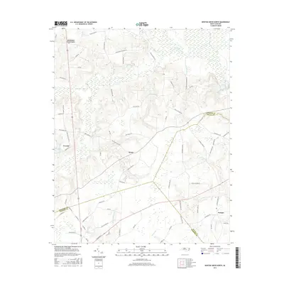
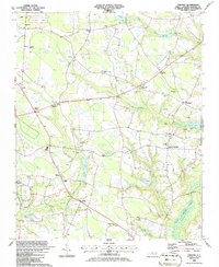
2016 Map of Newton Grove North
USGS Topo · Published 2016About this map
Strickland Crossroads and the small settlements of Overshot, Harper, and Starlight anchor this rural landscape where Johnston, Wayne, and Sampson counties converge. The terrain is defined by an intricate network of wetlands and drainage systems, notably Beaverdam Swamp and Kill Swamp, alongside water bodies such as J R Wells Lake and Blackman Pond. The presence of Battlefield Rd suggests the historical significance of the area, while the road network connects scattered farmsteads and rural residences through routes like Devils Racetrack Rd and Mill Creek Church Rd. This survey documents a quiet agrarian region where life remains oriented around traditional watercourses like Mill Cr and Hannah Cr. The map provides a clear view of local land use, from low-lying swampy bottoms to the higher ground occupied by established crossroads communities.
Find a feature on this map
75 named features on this map. Tap any name to fly to it.
Don’t see what you’re looking for? This feature index may not catch every label — zoom into the map to look around manually.
Map Details
Editions of this 2016 Newton Grove North Map
This is the sole edition of this map. No revisions or reprints were ever made.
Other maps of this area

1906 · Four Oaks
USGS Topo · 1:48,000

1908 · Four Oaks
USGS Topo · 1:62,500

1909 · Coharie
USGS Topo · 1:62,500

1953 · Raleigh
USGS Topo · 1:250,000

1954 · Raleigh
USGS Topo · 1:250,000

1974 · Grantham
USGS Topo · 1:24,000
1974 · Princeton
USGS Topo · 1:24,000
1978 · Dobbersville
USGS Topo · 1:24,000
1986 · Peacocks Crossroads
USGS Topo · 1:24,000
1986 · Timothy
USGS Topo · 1:24,000