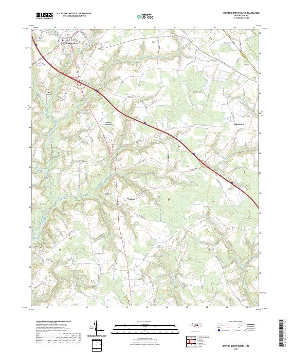
2022 Map of Newton Grove South
USGS Topo · Published 2022About this map
Newton Grove sits at the intersection of several historic transit routes, where the landscape transitions into the intricate drainage basins of the Sampson County interior. The terrain is defined by an extensive network of wetlands, including the broad Bull Pocosin and the winding Sevenmile Swamp. These water systems, which also include Great Coharie Cr and Beaverdam Swamp, dictated the historical placement of roads and small communities like Monks Crossroads and Hobbton. The map captures the persistence of these early rural centers amidst a landscape heavily influenced by both natural waterways and modern infrastructure. Genealogists and local historians will find value in the specific road names and the boundaries of old settlements like Suttentown and Ruby's Landing, which remain anchored to the same creek beds and swamp margins that have defined this region for generations.
Find a feature on this map
90 named features on this map. Tap any name to fly to it.
Don’t see what you’re looking for? This feature index may not catch every label — zoom into the map to look around manually.
Map Details
Editions of this 2022 Newton Grove South Map
This is the sole edition of this map. No revisions or reprints were ever made.
Other maps of this area

1906 · Four Oaks
USGS Topo · 1:48,000

1908 · Four Oaks
USGS Topo · 1:62,500

1909 · Coharie
USGS Topo · 1:62,500

1953 · Raleigh
USGS Topo · 1:250,000

1954 · Raleigh
USGS Topo · 1:250,000

1974 · Grantham
USGS Topo · 1:24,000

1975 · Faison
USGS Topo · 1:24,000
1978 · Dobbersville
USGS Topo · 1:24,000
1986 · Peacocks Crossroads
USGS Topo · 1:24,000
1986 · Timothy
USGS Topo · 1:24,000