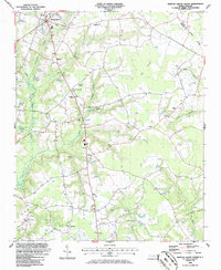
1986 Map of Newton Grove South
USGS Topo · Published 1986About this map
The agrarian landscape of Newton Grove and its surrounding coastal plain communities is defined by a complex network of wetlands and rural institutions. The drainage of Great Coharie Creek and Sevenmile Swamp crisscrosses the region, influencing the placement of early settlements and road networks. This mid-1980s topography reveals a high density of rural religious life, with numerous landmarks such as White Oak Ch, Pleasant Union Ch, and St Paul Ch serving as focal points for the community.
Find a feature on this map
33 named features on this map. Tap any name to fly to it.
Don’t see what you’re looking for? This feature index may not catch every label — zoom into the map to look around manually.
Map Details
Editions of this 1986 Newton Grove South Map
This is the sole edition of this map. No revisions or reprints were ever made.
Other maps of this area

1906 · Four Oaks
USGS Topo · 1:48,000

1908 · Four Oaks
USGS Topo · 1:62,500

1909 · Coharie
USGS Topo · 1:62,500

1953 · Raleigh
USGS Topo · 1:250,000

1954 · Raleigh
USGS Topo · 1:250,000

1974 · Grantham
USGS Topo · 1:24,000

1975 · Faison
USGS Topo · 1:24,000
1978 · Dobbersville
USGS Topo · 1:24,000
1986 · Peacocks Crossroads
USGS Topo · 1:24,000
1986 · Timothy
USGS Topo · 1:24,000