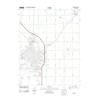
2012 Map of Newton
USGS Topo · Published 2012About this map
The educational and agricultural hub of Harvey County is centered around the Bethel College campus and its associated Bethel College Thresher Stadium, forming the core of North Newton. This map illustrates the transition from the concentrated residential streets of the city to the expansive surrounding farmland, where the Harvey County Fairgrounds serves as a local landmark. A network of creeks, including Sand Cr, Mud Cr, and the branches of W Fork Jester Cr, dictates the drainage of this Kansas prairie landscape.
Find a feature on this map
112 named features on this map. Tap any name to fly to it.
Don’t see what you’re looking for? This feature index may not catch every label — zoom into the map to look around manually.
Map Details
Editions of this 2012 Newton Map
This is the sole edition of this map. No revisions or reprints were ever made.
Other maps of this area

1889 · Newton
USGS Topo · 1:125,000

1889 · Wichita
USGS Topo · 1:125,000

1894 · Wichita
USGS Topo · 1:125,000

1894 · Newton
USGS Topo · 1:125,000

1955 · Wichita
USGS Topo · 1:250,000

1955 · Hutchinson
USGS Topo · 1:250,000

1957 · Newton
USGS Topo · 1:24,000

1957 · Peabody NW
USGS Topo · 1:24,000

1957 · Elbing
USGS Topo · 1:24,000

1958 · Wichita
USGS Topo · 1:250,000