
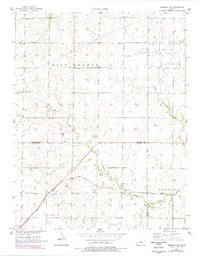
1957 Map of Peabody NW
USGS Topo · Published 1958About this map
The rolling prairies of the Marion and Harvey County line are captured in this mid-century survey, revealing a landscape defined by the winding course of Doyle Creek and the heavy presence of the Atchison Topeka and Santa Fe railroad. The agricultural character of the era is evidenced by a network of rural education sites, including Pleasant Valley Sch, Ridge Sch, and Center Sch, positioned to serve the farming families between East Branch and the township boundaries.
Find a feature on this map
17 named features on this map. Tap any name to fly to it.
Don’t see what you’re looking for? This feature index may not catch every label — zoom into the map to look around manually.
Map Details
Editions of this 1957 Peabody NW Map
2 editions found
Other maps of this area

1889 · Newton
USGS Topo · 1:125,000

1894 · Newton
USGS Topo · 1:125,000

1955 · Hutchinson
USGS Topo · 1:250,000

1957 · Newton
USGS Topo · 1:24,000

1957 · Peabody
USGS Topo · 1:24,000

1957 · Elbing
USGS Topo · 1:24,000

1959 · Hutchinson
USGS Topo · 1:250,000
1962 · Peabody SE
USGS Topo · 1:24,000

1965 · Goessel
USGS Topo · 1:24,000
1971 · Lehigh
USGS Topo · 1:24,000