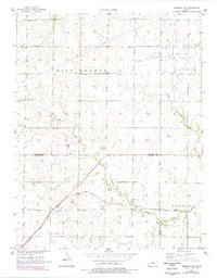
1957 Map of Peabody NW
USGS Topo · Published 1978About this map
Doyle Creek meanders across this rural landscape at the border of Marion and Harvey Counties during the late 1950s. The agricultural character of the region is punctuated by a network of rural schoolhouses, including Pleasant Valley Sch, Ridge Sch, and Center Sch, reflecting a time of localized community education before widespread consolidation. To the southeast, the Atchison Topeka and Santa Fe railroad cuts a diagonal path through the terrain, serving the local economy alongside the Oil Well operations in the Oil Field near Southwest Unger. Genealogists will find particular value in the clearly marked Dunkard Cem and Doyle Valley Cem, which provide specific anchor points for historical family research in this section of central Kansas.
Find a feature on this map
18 named features on this map. Tap any name to fly to it.
Don’t see what you’re looking for? This feature index may not catch every label — zoom into the map to look around manually.
Map Details
Editions of this 1957 Peabody NW Map
2 editions found
Other maps of this area

1889 · Newton
USGS Topo · 1:125,000

1894 · Newton
USGS Topo · 1:125,000

1955 · Hutchinson
USGS Topo · 1:250,000

1957 · Newton
USGS Topo · 1:24,000

1957 · Peabody NW
USGS Topo · 1:24,000

1957 · Peabody
USGS Topo · 1:24,000

1957 · Elbing
USGS Topo · 1:24,000

1959 · Hutchinson
USGS Topo · 1:250,000
1962 · Peabody SE
USGS Topo · 1:24,000

1965 · Goessel
USGS Topo · 1:24,000