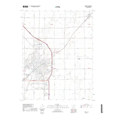
2018 Map of Newton
USGS Topo · Published 2018About this map
Newton and North Newton serve as the primary hubs in this Harvey County landscape, where the urban grid meets the agricultural reaches of central Kansas. The area is defined by a network of drainage systems including Sand Creek, Walnut Cr, and the forks of Jester Creek. This modern survey illustrates the contemporary integration of leisure and utility, featuring the Sand Creek Trail and the Trail of Two Cities alongside critical infrastructure like the Newton-City-County Airport. Beyond the main city limits, the map tracks smaller settlements such as Walton to the northeast and McLains to the southeast. For those researching local heritage, the map identifies significant land use markers including Greenwood Cem and Saint Mary's Cem, providing a precise look at the community's footprint in the late 2010s.
Find a feature on this map
38 named features on this map. Tap any name to fly to it.
Don’t see what you’re looking for? This feature index may not catch every label — zoom into the map to look around manually.
Map Details
Editions of this 2018 Newton Map
This is the sole edition of this map. No revisions or reprints were ever made.
Other maps of this area

1889 · Newton
USGS Topo · 1:125,000

1889 · Wichita
USGS Topo · 1:125,000

1894 · Wichita
USGS Topo · 1:125,000

1894 · Newton
USGS Topo · 1:125,000

1955 · Wichita
USGS Topo · 1:250,000

1955 · Hutchinson
USGS Topo · 1:250,000

1957 · Newton
USGS Topo · 1:24,000

1957 · Peabody NW
USGS Topo · 1:24,000

1957 · Elbing
USGS Topo · 1:24,000

1958 · Wichita
USGS Topo · 1:250,000