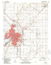
1989 Map of Newton
USGS Topo · Published 1990About this map
Newton and North Newton serve as the primary hubs of activity in this Harvey County landscape, where the confluence of several railroads and prairie creeks defines the region's development. The intersection of the Atchison Topeka and Santa Fe and the Missouri Pacific railroads created a transportation nexus that supported local institutions like Bethel College and multiple medical facilities, including Axtell Hospital and Bethel Deaconess Hospital.
Find a feature on this map
51 named features on this map. Tap any name to fly to it.
Don’t see what you’re looking for? This feature index may not catch every label — zoom into the map to look around manually.
Map Details
Editions of this 1989 Newton Map
This is the sole edition of this map. No revisions or reprints were ever made.
Other maps of this area

1889 · Newton
USGS Topo · 1:125,000

1889 · Wichita
USGS Topo · 1:125,000

1894 · Wichita
USGS Topo · 1:125,000

1894 · Newton
USGS Topo · 1:125,000

1955 · Wichita
USGS Topo · 1:250,000

1955 · Hutchinson
USGS Topo · 1:250,000

1957 · Newton
USGS Topo · 1:24,000

1957 · Peabody NW
USGS Topo · 1:24,000

1957 · Elbing
USGS Topo · 1:24,000

1958 · Wichita
USGS Topo · 1:250,000