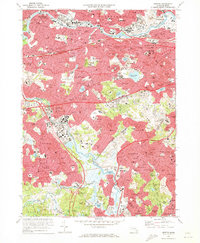
1970 Map of Newton
USGS Topo · Published 1973About this map
The Charles River defines the geography of these western Boston suburbs, winding through a landscape of established neighborhoods, academic institutions, and extensive parklands. By the early 1970s, the region is heavily urbanized, showing the significant footprint of the Massachusetts Turnpike and the Penn Central rail lines connecting Newton and Waltham to the city core. Large tracts of open space remain preserved in the south and east, including the Stony Brook Reservation and the sprawling Arnold Arboretum.
Find a feature on this map
122 named features on this map. Tap any name to fly to it.
Don’t see what you’re looking for? This feature index may not catch every label — zoom into the map to look around manually.
Map Details
Editions of this 1970 Newton Map
2 editions found
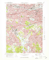
Other maps of this area

1886 · Dedham
USGS Topo · 1:62,500

1886 · Framingham
USGS Topo · 1:62,500

1887 · Franklin
USGS Topo · 1:62,500

1889 · Franklin
USGS Topo · 1:62,500

1889 · Framingham
USGS Topo · 1:62,500

1893 · Franklin
USGS Topo · 1:62,500

1893 · Boston
USGS Topo · 1:62,500

1894 · Dedham
USGS Topo · 1:62,500

1894 · Framingham
USGS Topo · 1:62,500

1903 · Boston
USGS Topo · 1:62,500