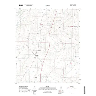
2018 Map of Newville
USGS Topo · Published 2018About this map
The town of Newville serves as the central hub of this Henry County landscape, where the local road network converges near the Newville Cem. To the south, the northern edge of Headland appears, illustrating the residential expansion toward the creek systems that define the area's drainage. The terrain is intricately carved by numerous small waterways, including Hodges-Mathis Mill Cr and Little Blackwood Cr, which reflect the region's agricultural and milling history. Small rural communities such as Danzey, Capps, and Tumbleton are situated along the secondary routes, many of which are anchored by long-standing landmarks like Union Springs Cem and Oaky Grove Cem. The presence of Griffin Pond and Lake Mila adds to the varied hydrography, showing how local water resources have shaped the placement of homes and farmsteads across these townships.
Find a feature on this map
91 named features on this map. Tap any name to fly to it.
Don’t see what you’re looking for? This feature index may not catch every label — zoom into the map to look around manually.
Map Details
Editions of this 2018 Newville Map
This is the sole edition of this map. No revisions or reprints were ever made.
Other maps of this area

1953 · Dothan
USGS Topo · 1:250,000

1954 · Dothan
USGS Topo · 1:250,000

1955 · Dothan
USGS Topo · 1:250,000

1969 · Abbeville West
USGS Topo · 1:24,000
1969 · Midland City
USGS Topo · 1:24,000
1969 · Clopton
USGS Topo · 1:24,000

1969 · Headland
USGS Topo · 1:24,000

1969 · Abbeville East
USGS Topo · 1:24,000
1969 · Echo
USGS Topo · 1:24,000

1969 · Newville
USGS Topo · 1:24,000