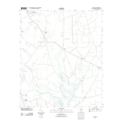
2011 Map of Neyles
USGS Topo · Published 2011About this map
Neyles sits at the center of this rural Colleton County landscape, where the agricultural and woodland patterns of the South Carolina Lowcountry remain clearly defined. The area is shaped by its proximity to the Ashepoo River, which snakes along the southern boundary, and the wetlands surrounding Chessey Creek and Horseshoe Creek. Long-standing settlement patterns are visible at Pendergrass Cross Roads and Pringle Bend, while family-named routes like Saint Peters Rd and Ritter Rd provide a framework for the local genealogy. This survey captures the transition from historic river-dependent life to modern road connectivity, evidenced by several key spans including Ivanhoe Bridge and Price Bridge. The map also records specialized land uses like the Bonnie Doone Hunting Clb, reflecting the region's traditional hunting and timber heritage.
Find a feature on this map
54 named features on this map. Tap any name to fly to it.
Don’t see what you’re looking for? This feature index may not catch every label — zoom into the map to look around manually.
Map Details
Editions of this 2011 Neyles Map
This is the sole edition of this map. No revisions or reprints were ever made.
Other maps of this area

1918 · Walterboro
USGS Topo · 1:62,500

1918 · Green Pond
USGS Topo · 1:62,500

1918 · Cottageville
USGS Topo · 1:62,500

1919 · Edisto Island
USGS Topo · 1:62,500

1943 · Cottageville
USGS Topo · 1:62,500

1943 · Edisto Island
USGS Topo · 1:62,500

1943 · Green Pond
USGS Topo · 1:62,500

1943 · Walterboro
USGS Topo · 1:62,500

1947 · Savannah
USGS Topo · 1:250,000

1948 · Savannah
USGS Topo · 1:250,000