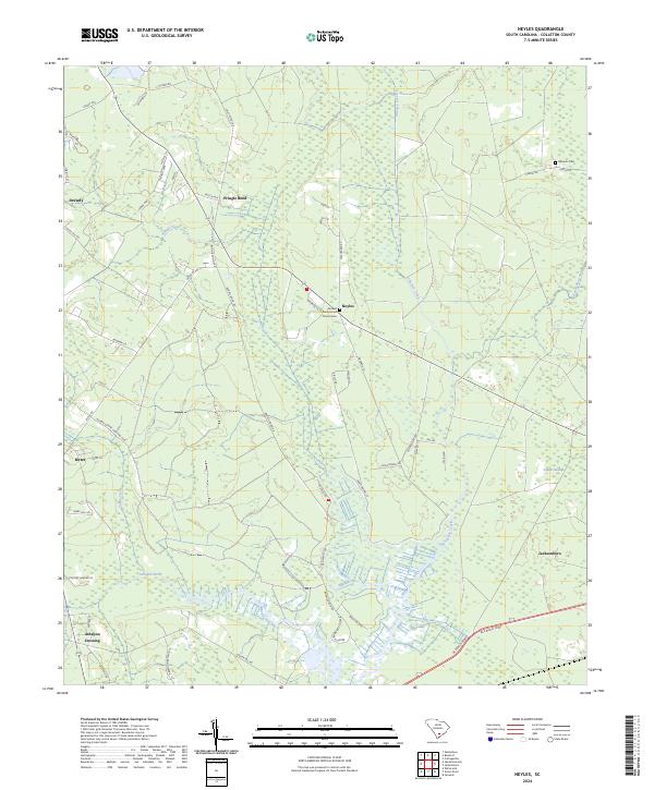
2024 Map of Neyles
USGS Topo · Published 2024About this map
The Ashepoo River and its labyrinthine tributaries define this Lowcountry landscape in Colleton County. Small residential clusters and historic crossroads like Neyles and Jacksonboro are scattered across a terrain dominated by wetlands, including the expansive Tupelo Swamp and Horseshoe Creek. Long-established community anchors are visible at the Aimwell Presbyterian Church Cem and the Baptist Conference Center, reflecting the area's deep-rooted social and religious history. Local land use is further illustrated by the Bonnie Doone Hunting Club and named points like Ashépoo Crossing, where the road network interacts with the river system. The presence of smaller family or community burial sites like Macauly Cem provides valuable data points for genealogists tracing regional lineages through these coastal wetlands and forests.
Find a feature on this map
56 named features on this map. Tap any name to fly to it.
Don’t see what you’re looking for? This feature index may not catch every label — zoom into the map to look around manually.
Map Details
Editions of this 2024 Neyles Map
This is the sole edition of this map. No revisions or reprints were ever made.
Other maps of this area

1918 · Walterboro
USGS Topo · 1:62,500

1918 · Green Pond
USGS Topo · 1:62,500

1918 · Cottageville
USGS Topo · 1:62,500

1919 · Edisto Island
USGS Topo · 1:62,500

1943 · Cottageville
USGS Topo · 1:62,500

1943 · Edisto Island
USGS Topo · 1:62,500

1943 · Green Pond
USGS Topo · 1:62,500

1943 · Walterboro
USGS Topo · 1:62,500

1947 · Savannah
USGS Topo · 1:250,000

1948 · Savannah
USGS Topo · 1:250,000