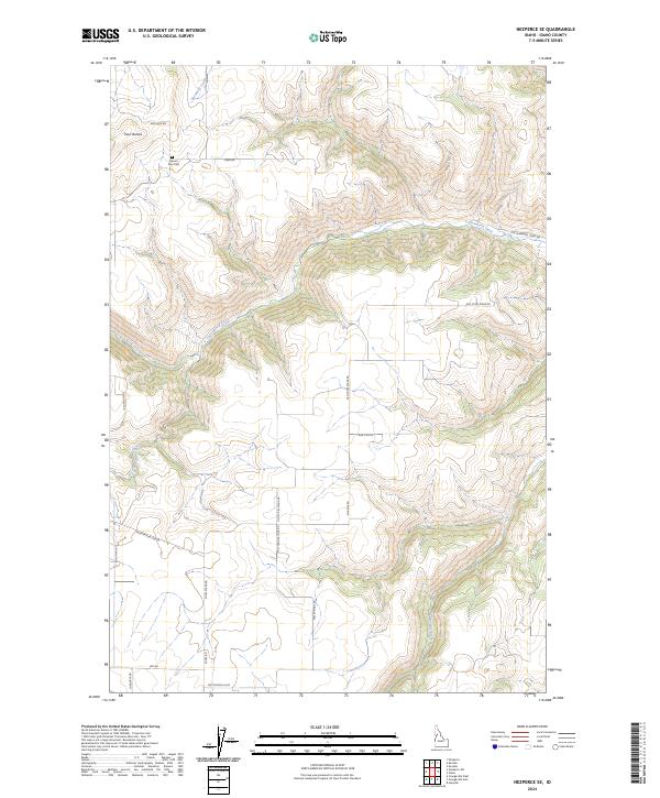
2024 Map of Nezperce SE
USGS Topo · Published 2024About this map
Mount Zion Cem sits on a high ridge in this section of Idaho County, overlooking a complex landscape of drainages and plateaued farmland. The geography is defined by deep incisions from Cottonwood Creek and its tributaries, including Sevenmile Creek and Red Rock Creek, which carve through the high prairie. The prominence of Twin Buttes serves as a local landmark in the northwestern corner of the quadrangle.
Find a feature on this map
25 named features on this map. Tap any name to fly to it.
Don’t see what you’re looking for? This feature index may not catch every label — zoom into the map to look around manually.
Map Details
Editions of this 2024 Nezperce SE Map
This is the sole edition of this map. No revisions or reprints were ever made.
Other maps of this area

1924 · Kamiah
USGS Topo · 1:125,000

1924 · Weippe
USGS Topo · 1:125,000

1931 · Buffalo Hump
USGS Topo · 1:125,000

1934 · Buffalo Hump
USGS Topo · 1:125,000

1955 · Pullman
USGS Topo · 1:250,000

1955 · Grangeville
USGS Topo · 1:250,000

1956 · Elk City
USGS Topo · 1:250,000

1956 · Hamilton
USGS Topo · 1:250,000

1958 · Pullman
USGS Topo · 1:250,000

1959 · Grangeville
USGS Topo · 1:250,000