
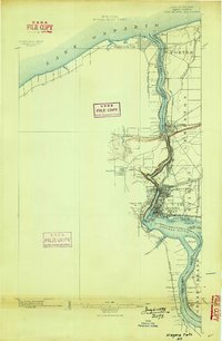
1896 Map of Niagara Falls
USGS Topo · Published 1896About this map
The United States Dominion of Canada Boundary Line serves as the central axis of this 1890s study, following the deep channel of the Niagara River from Lake Ontario south toward Grand Island. The map documents a critical period of industrial and transit expansion, where the massive river gorge is bridged by multiple rail lines including the N. Y. C. & H. R. R. R. and the Michigan Central R. R. at Suspension Bridge.
Find a feature on this map
44 named features on this map. Tap any name to fly to it.
Don’t see what you’re looking for? This feature index may not catch every label — zoom into the map to look around manually.
Map Details
Editions of this 1896 Niagara Falls Map
2 editions found
Other maps of this area

1894 · Buffalo
USGS Topo · 1:62,500

1894 · Niagara Falls
USGS Topo · 1:62,500

1894 · Wilson
USGS Topo · 1:62,500

1897 · Tonawanda
USGS Topo · 1:62,500

1899 · Niagara
USGS Topo · 1:125,000

1900 · Wilson
USGS Topo · 1:62,500

1900 · Tonawanda
USGS Topo · 1:62,500

1900 · Niagara Falls
USGS Topo · 1:62,500

1901 · Buffalo
USGS Topo · 1:62,500

1901 · Niagara Falls
USGS Topo · 1:62,500