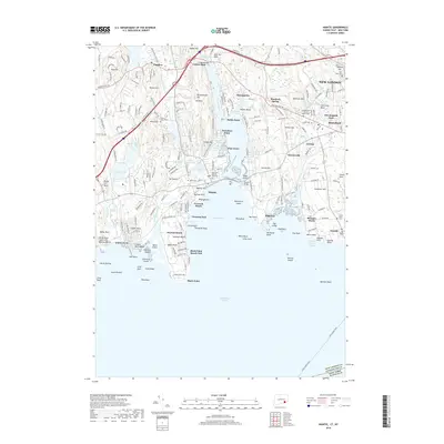
2018 Map of Niantic
USGS Topo · Published 2018About this map
Niantic Bay and the coastal landscapes of New London County define this contemporary view of the Connecticut shoreline. The complex interface of land and water is visible in the numerous coves and points, including Smith Cove and Saunders Point, which separate the village of Niantic from neighboring Oswegatchie. The map details the residential and recreational development of the late 2010s, from the beach communities of Attawan Beach and Crescent Beach to the rocky outcrops of Black Point. Inland, the terrain is shaped by hills such as Manitock Hill and Oswegatchie Hill, while a variety of local history sites are noted, including Stone Church Cem and the Congregation Ohave Sholem Cem. The presence of the Cross Sound Ferry route emphasizes the region's enduring role as a maritime transit hub.
Find a feature on this map
115 named features on this map. Tap any name to fly to it.
Don’t see what you’re looking for? This feature index may not catch every label — zoom into the map to look around manually.
Map Details
Editions of this 2018 Niantic Map
This is the sole edition of this map. No revisions or reprints were ever made.
Other maps of this area

1892 · New London
USGS Topo · 1:62,500

1893 · New London
USGS Topo · 1:62,500

1893 · Saybrook
USGS Topo · 1:62,500

1903 · Gardiners Island
USGS Topo · 1:62,500

1904 · Gardiners Island
USGS Topo · 1:62,500

1921 · Gardiners Island
USGS Topo · 1:62,500

1921 · New London
USGS Topo · 1:62,500

1934 · Niantic
USGS Topo · 1:24,000

1935 · Montville
USGS Topo · 1:24,000

1938 · New London
USGS Topo · 1:31,680