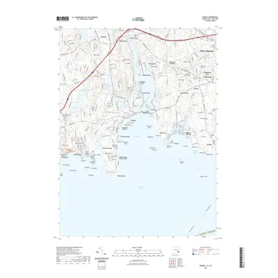
2021 Map of Niantic
USGS Topo · Published 2021About this map
Niantic Bay and the surrounding coastal reaches of New London define this maritime landscape in 2021. The deep indentations of the Niantic River and Jordan Cove create a series of distinct peninsulas, each with its own residential character, from the seasonal atmosphere of Black Point to the settled hills of Oswegatchie. The map reveals a dense network of family and community history, evidenced by longstanding sites like Jordan Cem and Saint Mary Cem, alongside landmarks such as the Stone Church. Long-distance transit history is marked by the path of the Boston Post Rd and the Cross Sound Ferry, which connects the Connecticut coast to New York. From the recreation-focused Rocky Neck State Park Bathing Beach to the residential enclaves of Crescent Beach and Pine Grove, the survey illustrates the modern configuration of this storied New England shoreline.
Find a feature on this map
107 named features on this map. Tap any name to fly to it.
Don’t see what you’re looking for? This feature index may not catch every label — zoom into the map to look around manually.
Map Details
Editions of this 2021 Niantic Map
This is the sole edition of this map. No revisions or reprints were ever made.
Other maps of this area

1892 · New London
USGS Topo · 1:62,500

1893 · New London
USGS Topo · 1:62,500

1893 · Saybrook
USGS Topo · 1:62,500

1903 · Gardiners Island
USGS Topo · 1:62,500

1904 · Gardiners Island
USGS Topo · 1:62,500

1921 · Gardiners Island
USGS Topo · 1:62,500

1921 · New London
USGS Topo · 1:62,500

1934 · Niantic
USGS Topo · 1:24,000

1935 · Montville
USGS Topo · 1:24,000

1938 · New London
USGS Topo · 1:31,680