
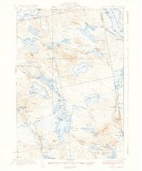
1934 Map of Nicatous Lake
USGS Topo · Published 1948About this map
The Passadumkeag River flows through the northwestern corner of this territory, where the early 1930s landscape is defined by its complex chain of glacial lakes and isolated camps. The map captures a transitional era in Maine's north woods, where remote outposts like Poplar Tavern and the Nicatous Club served as hubs for sport and timber interests. The survey detail reveals a patchwork of townships and numbered districts, such as T 4 ND and T 41 MD, illustrating the systematic land divisions that shaped the region's development before modern infrastructure reached these interior waters.
Find a feature on this map
105 named features on this map. Tap any name to fly to it.
Don’t see what you’re looking for? This feature index may not catch every label — zoom into the map to look around manually.
Map Details
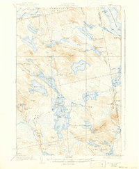
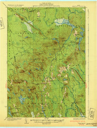
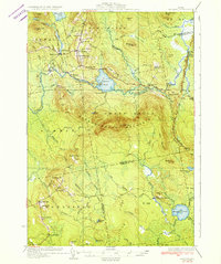
Editions of this 1934 Nicatous Lake Map
4 editions found
Other maps of this area

1920 · Winn
USGS Topo · 1:62,500

1929 · Great Pond
USGS Topo · 1:48,000

1929 · Lead Mountain
USGS Topo · 1:48,000

1931 · Springfield
USGS Topo · 1:48,000

1931 · Saponac
USGS Topo · 1:48,000

1932 · Nicatous Lake
USGS Topo · 1:48,000

1932 · Lead Mountain
USGS Topo · 1:62,500
1932 · Great Pond
USGS Topo · 1:62,500
1934 · Saponac
USGS Topo · 1:62,500

1934 · Nicatous Lake
USGS Topo · 1:62,500