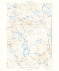
1934 Map of Nicatous Lake
USGS Topo · Published 1934About this map
The remote lakes and rugged ridges of eastern Maine define this landscape as it was surveyed in the early 1930s. Centered on the sprawling waters of Nicatous Lake, the area is punctuated by islands like Sand I and Cranberry I, and several sporting and forestry camps. The Nicatous Club and Explorers Club indicate the region's importance for early 20th-century outdoor recreation and conservation near the Hancock and Washington County line.
Find a feature on this map
102 named features on this map. Tap any name to fly to it.
Don’t see what you’re looking for? This feature index may not catch every label — zoom into the map to look around manually.
Map Details
Editions of this 1934 Nicatous Lake Map
4 editions found
Other maps of this area

1920 · Winn
USGS Topo · 1:62,500

1929 · Great Pond
USGS Topo · 1:48,000

1929 · Lead Mountain
USGS Topo · 1:48,000

1931 · Springfield
USGS Topo · 1:48,000

1931 · Saponac
USGS Topo · 1:48,000

1932 · Nicatous Lake
USGS Topo · 1:48,000

1932 · Lead Mountain
USGS Topo · 1:62,500

1932 · Great Pond
USGS Topo · 1:62,500

1934 · Saponac
USGS Topo · 1:62,500

1934 · Nicatous Lake
USGS Topo · 1:62,500