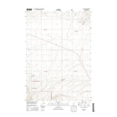
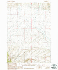
2013 Map of Nicholia
USGS Topo · Published 2013About this map
Nicholia sits at the foot of the mountains where Smelter Gulch meets the valley floor, marking a site of early industrial activity in Lemhi County. The landscape is defined by the drainage systems of Birch Cr and Willow Cr, which flow through a region of high-elevation canyons and gulches. To the south, the boundary of the Targhee National Forest encompasses steep terrain including McCoy Canyon and Meadow Canyon. The map reveals a network of Forest Service roads such as NFD 541 Rd and NFD 188 Rd that provide access to remote water sources like Magpie Spring and Sagebrush Spring. This 2013 survey illustrates the modern configuration of the historic Nicholia Ranch Rd, tracing the legacy of ranching and mining transport in this corner of Idaho.
Find a feature on this map
25 named features on this map. Tap any name to fly to it.
Don’t see what you’re looking for? This feature index may not catch every label — zoom into the map to look around manually.
Map Details
Editions of this 2013 Nicholia Map
This is the sole edition of this map. No revisions or reprints were ever made.
Other maps of this area

1955 · Dubois
USGS Topo · 1:250,000

1956 · Nicholia
USGS Topo · 1:62,500

1957 · Diamond Peak
USGS Topo · 1:62,500

1957 · Scott Peak
USGS Topo · 1:62,500

1958 · Dubois
USGS Topo · 1:250,000
1969 · Blue Dome
USGS Topo · 1:24,000

1983 · Dubois
USGS Topo · 1:100,000
1987 · Eighteenmile Peak
USGS Topo · 1:24,000
1987 · Gilmore Summit
USGS Topo · 1:24,000
1987 · Nicholia
USGS Topo · 1:24,000