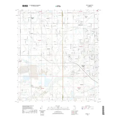
2018 Map of Nichols
USGS Topo · Published 2018About this map
Bealsville and the phosphate-rich corridor between Plant City and Mulberry define this landscape on the border of Hillsborough and Polk Counties. This modern survey illustrates the complex drainage patterns of the N Prong Alafia River and Poley Creek, which wind through industrial and agricultural lands. The map details smaller settlements like Coronet, Trapnell, and Willow Oak, alongside the eponymous company town of Nichols. Transportation infrastructure is a dominant feature, from the massive footprint of the Lakeland Linder Regional Airport to the CSX Transportation rail lines that once served the region's mining and citrus industries. Researchers can locate local landmarks like Springhead Cem and Little Alafia Cem, which anchor the historical geography of these tight-knit Florida communities.
Find a feature on this map
116 named features on this map. Tap any name to fly to it.
Don’t see what you’re looking for? This feature index may not catch every label — zoom into the map to look around manually.
Map Details
Editions of this 2018 Nichols Map
This is the sole edition of this map. No revisions or reprints were ever made.
Other maps of this area

1944 · Plant City
USGS Topo · 1:31,680

1944 · Lakeland
USGS Topo · 1:31,680

1944 · Antioch
USGS Topo · 1:31,680

1949 · Mulberry
USGS Topo · 1:24,000

1949 · Bradley Junction
USGS Topo · 1:24,000

1950 · Mulberry
USGS Topo · 1:24,000

1950 · Bradley Junction
USGS Topo · 1:24,000

1955 · Lithia
USGS Topo · 1:24,000

1955 · Nichols
USGS Topo · 1:24,000

1955 · Dover
USGS Topo · 1:24,000