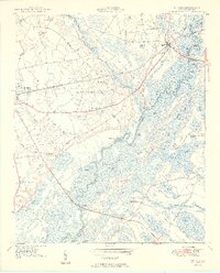
1950 Map of Nichols
USGS Topo · Published 1950About this map
The Little Pee Dee River and Lumber River define the intricate hydrological landscape between Mullins and Nichols. In 1950, this area of the South Carolina Coastal Plain was a complex network of swamps and named oxbow lakes, including Huggins Lake, Round Hole Lake, and Willow Lake. The Atlantic Coast Line railroad and US Highway 76 serve as the primary east-west conduits, crossing the river near the confluence of Ashpole Swamp.
Find a feature on this map
89 named features on this map. Tap any name to fly to it.
Don’t see what you’re looking for? This feature index may not catch every label — zoom into the map to look around manually.
Map Details
Editions of this 1950 Nichols Map
2 editions found

Other maps of this area

1943 · Pages Mill
USGS Topo · 1:62,500

1946 · Mullins
USGS Topo · 1:24,000

1947 · Centenary
USGS Topo · 1:24,000

1947 · Mullins
USGS Topo · 1:24,000

1948 · Galivants Ferry
USGS Topo · 1:24,000

1948 · Nichols
USGS Topo · 1:24,000

1948 · Bayboro
USGS Topo · 1:24,000

1949 · Bayboro
USGS Topo · 1:24,000

1949 · Duford
USGS Topo · 1:24,000

1950 · Galivants Ferry
USGS Topo · 1:24,000