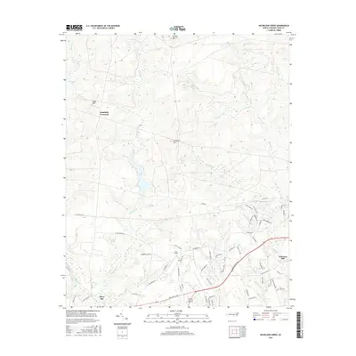
2016 Map of Nicholson Creek
USGS Topo · Published 2016About this map
Campbells Crossroad and Silver City anchor this landscape in North Carolina, where the terrain is defined by a dense network of tributaries feeding into Nicholson Cr. The topography is marked by several distinct elevations, including Gaddys Mtn, Blues Mtn, and Finlayson Mtn, which overlook the significant water features of McKieihan Pond and Mott Lake. This area demonstrates a modern transition from rural crossroads to more formal infrastructure, evidenced by the presence of P K Airpark and a growing grid of residential roads like Somerset Dr and Cavalier Dr. To the southeast, Johnsons Mill stands near the confluence of Puppy Cr and Big Cr, highlighting the historical reliance on local waterways. The prominence of the All American Trl indicates the region's evolving role in land management and recreational access alongside established routes like Plank Rd.
Find a feature on this map
67 named features on this map. Tap any name to fly to it.
Don’t see what you’re looking for? This feature index may not catch every label — zoom into the map to look around manually.
Map Details
Editions of this 2016 Nicholson Creek Map
This is the sole edition of this map. No revisions or reprints were ever made.
Other maps of this area

1948 · Southern Pines
USGS Topo · 1:62,500

1948 · Clifdale
USGS Topo · 1:62,500

1948 · Nicholson Creek
USGS Topo · 1:24,000

1948 · Clifdale
USGS Topo · 1:24,000

1948 · Mc Cain
USGS Topo · 1:24,000

1949 · Wagram
USGS Topo · 1:24,000

1949 · Laurinburg
USGS Topo · 1:62,500

1950 · Clifdale
USGS Topo · 1:24,000

1950 · Sanatorium
USGS Topo · 1:24,000

1950 · Lobelia
USGS Topo · 1:24,000