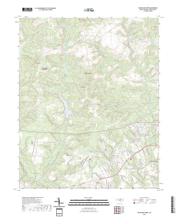
2022 Map of Nicholson Creek
USGS Topo · Published 2022About this map
Nicholson Creek flows through this North Carolina landscape, feeding into Mott Lake and carving a drainage network that defines the region's topography. Small named peaks like Finlayson Mtn, Blues Mtn, and Gaddys Mtn rise above the surrounding terrain, marking the local elevation. The map illustrates a transition between the rural crossroads of Campbells Crossroad and the developing residential corridors near Fayetteville Rd. Transportation and infrastructure are central to the area's layout, featuring aviation hubs like Raeford West Airport and P K Airpark. The presence of the All American Trl indicates the area's integration with regional recreational or military transit networks. Historically grounded locations such as Johnsons Mill on the eastern edge provide points of interest for those tracing the intersection of water-driven industry and community growth along the Puppy Cr and Rockfish Cr watersheds.
Find a feature on this map
75 named features on this map. Tap any name to fly to it.
Don’t see what you’re looking for? This feature index may not catch every label — zoom into the map to look around manually.
Map Details
Editions of this 2022 Nicholson Creek Map
This is the sole edition of this map. No revisions or reprints were ever made.
Other maps of this area

1948 · Southern Pines
USGS Topo · 1:62,500

1948 · Clifdale
USGS Topo · 1:62,500

1948 · Nicholson Creek
USGS Topo · 1:24,000

1948 · Clifdale
USGS Topo · 1:24,000

1948 · Mc Cain
USGS Topo · 1:24,000

1949 · Wagram
USGS Topo · 1:24,000

1949 · Laurinburg
USGS Topo · 1:62,500

1950 · Clifdale
USGS Topo · 1:24,000

1950 · Sanatorium
USGS Topo · 1:24,000

1950 · Lobelia
USGS Topo · 1:24,000