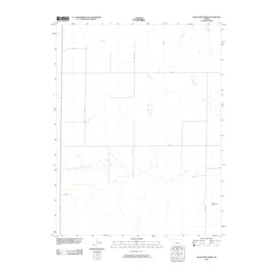
2009 Map of Nickel Mine Spring
USGS Topo · Published 2009About this map
Twin Butte Creek meanders through the heart of this Logan County landscape, carving a distinctive path across the High Plains in the early 21st century. The terrain is structured by a grid of rural roads, including Lariat, Kiowa, and Hunter, which mark the vast agricultural spaces typical of western Kansas. This survey captures a moment in the region's land management and aviation history, evidenced by Mollenkamp Field in the southeastern corner. The sparse distribution of named points like Fawn underscores the open, low-density character of the area, where water sources and landing strips are significant landmarks for residents and aviators alike. This 2009 edition serves as a precise record of the physical and transportation infrastructure prior to subsequent changes in county road numbering or regional development.
Find a feature on this map
9 named features on this map. Tap any name to fly to it.
Don’t see what you’re looking for? This feature index may not catch every label — zoom into the map to look around manually.
Map Details
Editions of this 2009 Nickel Mine Spring Map
This is the sole edition of this map. No revisions or reprints were ever made.
Other maps of this area

1939 · Pence
USGS Topo · 1:62,500

1941 · Pence
USGS Topo · 1:62,500

1955 · Scott City
USGS Topo · 1:250,000

1958 · Scott City
USGS Topo · 1:250,000

1968 · Russell Springs 3 NW
USGS Topo · 1:24,000

1968 · Russell Springs 3 NE
USGS Topo · 1:24,000

1969 · Russell Springs 2 NW
USGS Topo · 1:24,000

1969 · Russell Springs 2 SW
USGS Topo · 1:24,000

1969 · Russell Springs 2 NE
USGS Topo · 1:24,000

1969 · Russell Springs 2 SE
USGS Topo · 1:24,000