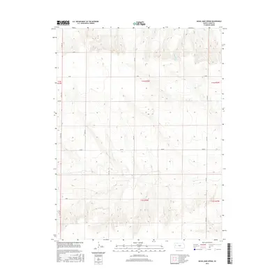
2015 Map of Nickel Mine Spring
USGS Topo · Published 2015About this map
Nickel Mine Spring marks a rare water source in this high plains landscape of western Kansas, where the terrain is defined by a systematic grid of section lines and rural thoroughfares. The local transportation network relies on a series of named and numbered routes, including Co Rd 160, Co Rd 190, and Co Rd 220, which facilitate movement across the agricultural townships. Named roads like Lariat, Jayhawk, and Kiowa suggest a landscape deeply rooted in the ranching and local heritage of Logan County. This 2015 U.S. Geological Survey representation details the modern boundaries of several townships, including t14s r36w and t15s r36w, illustrating how the Public Land Survey System continues to organize the geography of the Great Plains into the 21st century.
Find a feature on this map
17 named features on this map. Tap any name to fly to it.
Don’t see what you’re looking for? This feature index may not catch every label — zoom into the map to look around manually.
Map Details
Editions of this 2015 Nickel Mine Spring Map
This is the sole edition of this map. No revisions or reprints were ever made.
Other maps of this area

1939 · Pence
USGS Topo · 1:62,500

1941 · Pence
USGS Topo · 1:62,500

1955 · Scott City
USGS Topo · 1:250,000

1958 · Scott City
USGS Topo · 1:250,000

1968 · Russell Springs 3 NW
USGS Topo · 1:24,000

1968 · Russell Springs 3 NE
USGS Topo · 1:24,000

1969 · Russell Springs 2 NW
USGS Topo · 1:24,000

1969 · Russell Springs 2 SW
USGS Topo · 1:24,000

1969 · Russell Springs 2 NE
USGS Topo · 1:24,000

1969 · Russell Springs 2 SE
USGS Topo · 1:24,000