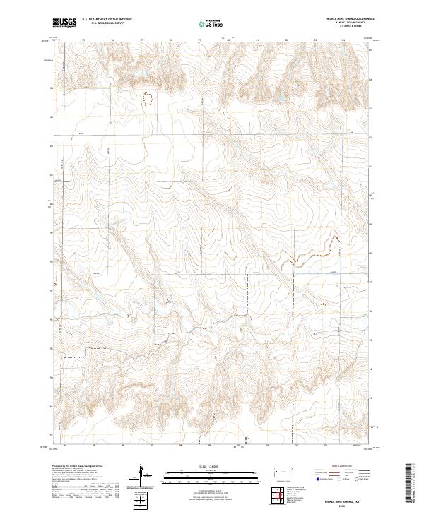
2022 Map of Nickel Mine Spring
USGS Topo · Published 2022About this map
Nickel Mine Spring sits in the northern section of this Logan County landscape, a localized water source in a region primarily defined by its topographic relief and a structured grid of rural corridors. The terrain is deeply incised by drainages that flow through the various townships, including t14s r36w and t15s r36w. This network of draws and ridges creates a complex natural pattern that contrasts with the geometric precision of the county road system. Named thoroughfares like Lariat, Kiowa, and Jayhawk run east-west across the section lines, providing the primary infrastructure for the dispersed ranching or farming operations in this part of western Kansas. The map captures the intersection of natural drainage systems and human-imposed boundaries, where roads such as Co Rd 160 and Co Rd 190 navigate the broken ground of the high plains.
Find a feature on this map
18 named features on this map. Tap any name to fly to it.
Don’t see what you’re looking for? This feature index may not catch every label — zoom into the map to look around manually.
Map Details
Editions of this 2022 Nickel Mine Spring Map
This is the sole edition of this map. No revisions or reprints were ever made.
Other maps of this area

1939 · Pence
USGS Topo · 1:62,500

1941 · Pence
USGS Topo · 1:62,500

1955 · Scott City
USGS Topo · 1:250,000

1958 · Scott City
USGS Topo · 1:250,000

1968 · Russell Springs 3 NW
USGS Topo · 1:24,000

1968 · Russell Springs 3 NE
USGS Topo · 1:24,000

1969 · Russell Springs 2 NW
USGS Topo · 1:24,000

1969 · Russell Springs 2 SW
USGS Topo · 1:24,000

1969 · Russell Springs 2 NE
USGS Topo · 1:24,000

1969 · Russell Springs 2 SE
USGS Topo · 1:24,000