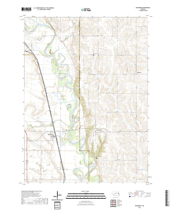
2021 Map of Nickerson
USGS Topo · Published 2021About this map
The Elkhorn River carves a complex, meandering path through this landscape on the border of Dodge County and Washington County. The river's historical shifts are evidenced by numerous oxbows and cutoffs, including Fish Lake, Moss Lake, and Snyder Lake. The settlement of Nickerson is situated just north of Maple Creek, while the community of Fontanelle lies to the east along the county line. The presence of the Logan Creek Dredge in the northwest corner highlights the region's history of water management and land reclamation efforts. Local history is further preserved in small rural sites like Immanuel Cem and Hartung Cem, which serve as quiet markers of the area's agricultural heritage. The modern Lower Elkhorn River Trl follows the river's winding course, providing a physical link through the river valley's riparian corridor.
Find a feature on this map
50 named features on this map. Tap any name to fly to it.
Don’t see what you’re looking for? This feature index may not catch every label — zoom into the map to look around manually.
Map Details
Editions of this 2021 Nickerson Map
This is the sole edition of this map. No revisions or reprints were ever made.
Other maps of this area

1893 · Fremont
USGS Topo · 1:125,000

1896 · Fremont
USGS Topo · 1:125,000

1899 · Wahoo
USGS Topo · 1:125,000

1955 · Fremont
USGS Topo · 1:250,000

1957 · Fremont
USGS Topo · 1:250,000

1958 · Fremont
USGS Topo · 1:250,000

1966 · Uehling
USGS Topo · 1:24,000

1966 · Nickerson
USGS Topo · 1:24,000

1966 · Hooper
USGS Topo · 1:24,000

1966 · Nickerson NW
USGS Topo · 1:24,000