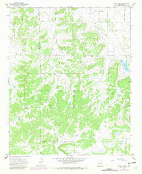
1967 Map of Nicoll Lake
USGS Topo · Published 1981About this map
Candy Kitchen and the surrounding Ramah Indian Area define this high-elevation landscape along the border of McKinley and Cibola counties. The terrain is characterized by a complex network of seasonal drainage channels, including Horse Draw, White Draw, and Crockett Draw, which carve through the arid topography toward Nicoll Lake. The presence of the Ramah Navajo Community Center in the northeast quadrant highlights the importance of this region as a center for the local Navajo community during the mid-to-late 20th century. Scattered wells and ephemeral watercourses like Loma del Draw and Terrero Draw suggest a landscape where water management was critical for ranching or subsistence. This 1967 survey, with 1978 revisions, provides a clear record of the rural infrastructure and boundary lines in a culturally significant portion of New Mexico.
Find a feature on this map
12 named features on this map. Tap any name to fly to it.
Don’t see what you’re looking for? This feature index may not catch every label — zoom into the map to look around manually.
Map Details
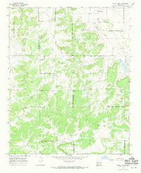
Editions of this 1967 Nicoll Lake Map
2 editions found
Other maps of this area

1886 · Wingate
USGS Topo · 1:250,000

1892 · Wingate
USGS Topo · 1:250,000

1954 · Saint Johns
USGS Topo · 1:250,000

1954 · Gallup
USGS Topo · 1:250,000

1957 · Saint Johns
USGS Topo · 1:250,000

1958 · Gallup
USGS Topo · 1:250,000

1958 · Saint Johns
USGS Topo · 1:250,000

1959 · Gallup
USGS Topo · 1:250,000

1962 · Gallup
USGS Topo · 1:250,000

1962 · Saint Johns
USGS Topo · 1:250,000
Featured Places
- Eastern Navajo Agency, NM
- Pinehill, Eastern Navajo Agency
- Mountain View, Eastern Navajo Agency
- McKinley County, NM
- Cibola County, NM