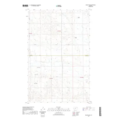
2020 Map of Nielsen Coulee
USGS Topo · Published 2020About this map
Poplar River winds through the eastern edge of this landscape, marking a significant hydrologic feature in the Wolf Point District. The terrain is defined by a dense network of coulees that drain the high ground, creating a complex series of ridges and draws. These features, including Nielsen Coulee, Cabarett Coulee, and Jakes Coulee, illustrate the erosion patterns characteristic of this part of northern Montana. The county line between Daniels Co and Roosevelt Co bisects the map, providing a administrative reference point for researchers studying property and regional boundaries. A sparse grid of rural routes such as Lekvold Rd and W Susag Rd provides the primary access across the township and range sections, connecting isolated drainage basins like Reiner Coulee and Krause Coulee to the larger river valley.
Find a feature on this map
21 named features on this map. Tap any name to fly to it.
Don’t see what you’re looking for? This feature index may not catch every label — zoom into the map to look around manually.
Map Details
Editions of this 2020 Nielsen Coulee Map
This is the sole edition of this map. No revisions or reprints were ever made.
Other maps of this area

1910 · Cuskers
USGS Topo · 1:62,500

1915 · Tule Valley
USGS Topo · 1:62,500

1915 · Cuskers
USGS Topo · 1:62,500

1954 · Wolf Point
USGS Topo · 1:250,000

1958 · Wolf Point
USGS Topo · 1:250,000

1973 · Peerless 4 NE
USGS Topo · 1:24,000

1973 · Bredette
USGS Topo · 1:24,000

1973 · Line Coulee
USGS Topo · 1:24,000

1973 · Nielsen Coulee
USGS Topo · 1:24,000

1973 · Cabarett Coulee
USGS Topo · 1:24,000