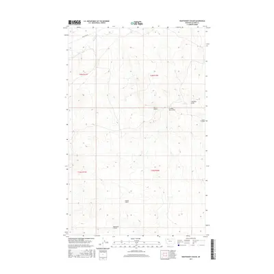
2017 Map of Nightshoot Coulee
USGS Topo · Published 2017About this map
Milk River meanders across the northern reaches of this high plains landscape, defining the local hydrology in a region characterized by dramatic drainage systems. The terrain is deeply inscribed by numerous coulees, including Nightshoot Coulee, Hoodoo Coulee, and Little Rock Coulee, which serve as natural landmarks and drainage channels through the prairie. These geographic features, along with Cut Bank John Coulee and Cobell Coulee, illustrate the erosion patterns typical of the Montana plains. Buck Ranch Rd provides the primary overland access through the northern section, highlighting the sparse infrastructure of this ranching country. The map captures the systematic Public Land Survey System layout, dividing the area into townships such as t36n r10w and t35n r11w, which historically governed land claims and settlement in the region.
Find a feature on this map
11 named features on this map. Tap any name to fly to it.
Don’t see what you’re looking for? This feature index may not catch every label — zoom into the map to look around manually.
Map Details
Editions of this 2017 Nightshoot Coulee Map
This is the sole edition of this map. No revisions or reprints were ever made.
Other maps of this area

1901 · Browning
USGS Topo · 1:125,000

1903 · Browning
USGS Topo · 1:125,000

1911 · Blackfoot
USGS Topo · 1:125,000

1960 · Cut Bank
USGS Topo · 1:250,000

1963 · Cut Bank
USGS Topo · 1:250,000

1964 · Cut Bank
USGS Topo · 1:250,000

1968 · Rimrock Butte
USGS Topo · 1:24,000

1968 · Hoodoo Hill
USGS Topo · 1:24,000

1968 · Browning NE
USGS Topo · 1:24,000
1968 · Emigrant Gap
USGS Topo · 1:24,000