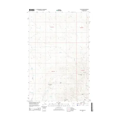
2014 Map of Niles Coulee
USGS Topo · Published 2014About this map
Niles Coulee and its neighboring drainage systems define this section of Valley County, Montana, showing a landscape shaped by intermittent water and pastoral management. The terrain is marked by a network of seasonal watercourses including Ten Trees Cr and Timber Cr, which feed into numerous small-scale water management features. Ranching infrastructure is evident through the presence of Corral Reservoir, Mc Kee Reservoir, and Anderson Reservoir, points of vital importance in this arid environment. Navigation across these remote tracts is limited to established routes like Ridge Rd and Anderson Rd, which follow the contours of the high ground between the coulees. The map details the complex geography of Little Frenchman Coulee and North Frenchman Coulee, providing a clear record of the area's physical characteristics and boundary divisions under the Public Land Survey System.
Find a feature on this map
20 named features on this map. Tap any name to fly to it.
Don’t see what you’re looking for? This feature index may not catch every label — zoom into the map to look around manually.
Map Details
Editions of this 2014 Niles Coulee Map
This is the sole edition of this map. No revisions or reprints were ever made.
Other maps of this area

1954 · Jordan
USGS Topo · 1:250,000

1954 · Glasgow
USGS Topo · 1:250,000

1956 · Jordan
USGS Topo · 1:250,000

1957 · Glasgow
USGS Topo · 1:250,000

1958 · Glasgow
USGS Topo · 1:250,000

1958 · Jordan
USGS Topo · 1:250,000

1964 · Jordan
USGS Topo · 1:250,000

1973 · Triple Crossing Reservoir West
USGS Topo · 1:24,000

1973 · Niles Coulee
USGS Topo · 1:24,000
1973 · Gibson Coulee
USGS Topo · 1:24,000